
MAGNUS.TOWN
:
Using OSINT to reverse engineer a lost camera's journey
28 December, 2025
I found a camera that didn't belong to me. It was half-buried in old seaweed on the shoreline at Ølve, in late December 2025. It was a Triacle camera, which is a GoPro style action camera. It had a waterproof casing and a mount that had apparently fallen off.
The casing was battered by salt and stone, but the camera seemed intact. After opening the case and examining the device, it seemed okay. It even contained an SD card, which was very interesting. After looking at the footage, I found over one hour of video. I decided to edit the footage to document the camera's last journey.
As I worked on this, I became determined to figure out the camera's exact location as well. By treating the footage as an OSINT puzzle and analyzing the sun's position, time of day, terrain, seabed, trees and rock formations. I managed to trace its journey to a location where I am fairly certain the footage ended.
Timeline
Looking at the footage, I made a rough timeline of events to get started. The camera contained timestamps in the footage, which were quite useful.
| Timestamp (11.06.2024 UTC+2) | Event | Observation |
|---|---|---|
| 19:37 | Camera Lost | The camera falls into the water. |
| 20:08 | Initial Bottom Contact | The seabed suddenly becomes visible. |
| 20:08 - 20:13 | Active Drift | Movement over a shallow, seaweed-covered plateau. |
| 20:13 - 20:17 | Very shallow drift | The camera is trapped in a pocket of seaweed/rocks and drifts really slow |
| 20:17 | Landing (Impact) | The camera strikes an object and eventually comes to a complete stop. |
| 20:20 | Visuals | The sun is low with rocks, trees, and mountains visible. |
| 20:44 | Recording Terminates | |
| June 2024 – Dec 2025 | Traveling (~560 days) | The camera travels to the opposite side of the fjord. |
| Late Dec 2025 | Recovery | The camera is found at Ølve. |
The RAW footage
The footage from the lost camera can be seen on YouTube in 4K. If you see something interesting, let me know.
Where it all started
In the first scenes, you can see some boathouses and mountains in the background, as well as a concrete slope leading down to the fjord. We could immediately see that this was not in the part of the fjord where we found the camera (Ølve in the Hardangerfjord).
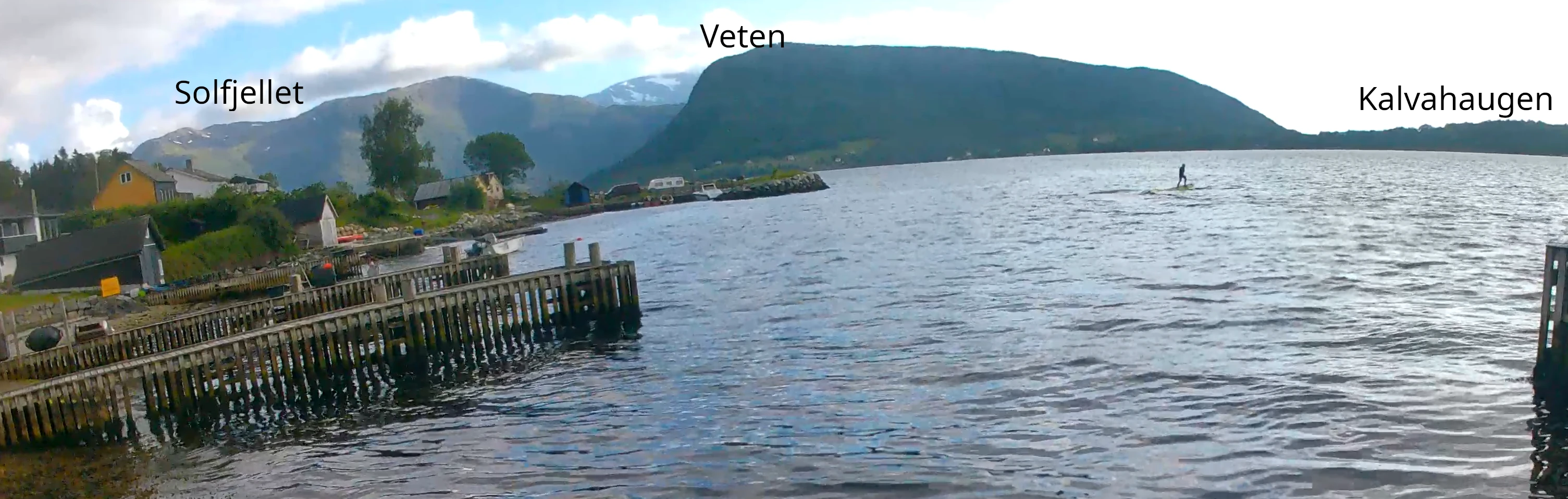
Some locals pointed out that this might be on the Rosendal side of the fjord, which is a 20–30 minute boat ride from where we found it. And sure enough, the locals were correct. Looking at Google Street View in the SW direction from Rosendal, the mountain ranges were exactly the same.
Now it was all down to finding the exact boathouses from which the camera was filming. It didn't take long to find them by looking at the shoreline north of Rosendal at "Beinavika." The video shows a person riding an e-foil board, eventually crashing and losing the camera in the process. Most likely, he was not far out on the fjord, but somewhere between Kalvahaugen and Beinavika. Probably closer to where he started from.
Current
The video then shows a lot of drifting in the water before hitting the shore close to some rocks. The next step was to look at where the surface current was. Luckily, there is a map for just that.
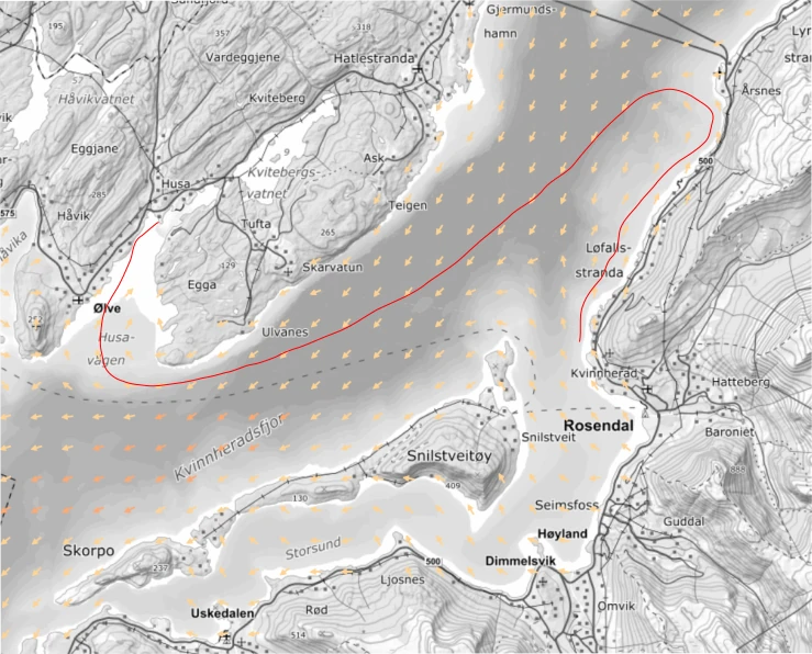
The contrast in this map is quite low, but I tried to draw with a red marker where I think the camera might have drifted based on the current alone. We know for sure it started in Beinavika and ended up in Ølve. How exactly it managed to get there is a mystery. Based on the timeline, it drifts for 30 minutes before hitting the shoreline. This is too short a time to reach the other side of the fjord, meaning it must still be on the Rosendal side.
Narrowing down the possible location
A lot of the footage is just underwater, but around 20:16–20:22, it hits a rock and films upward for some time before turning around again. Based on just this, a lot of interesting information can be extracted that narrows down the potential areas significantly.
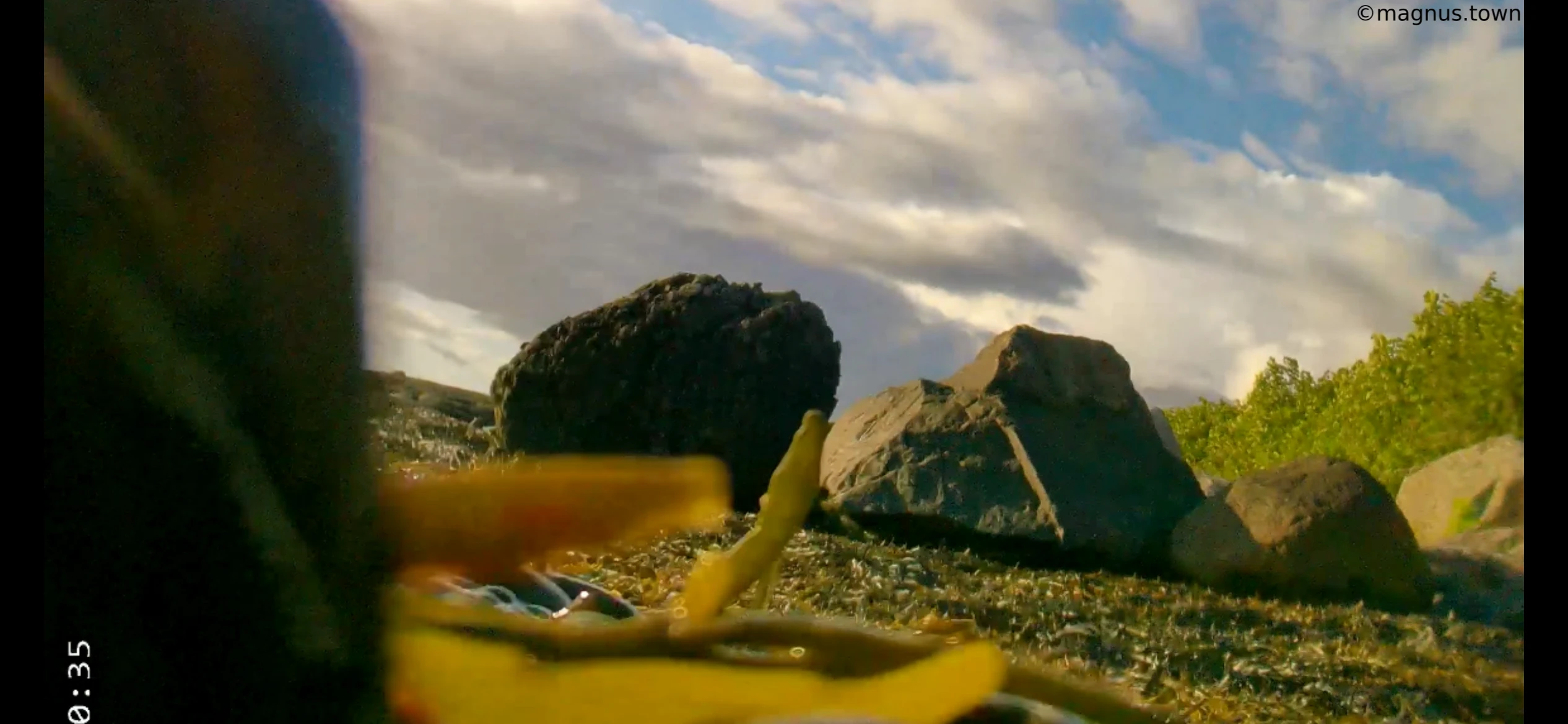
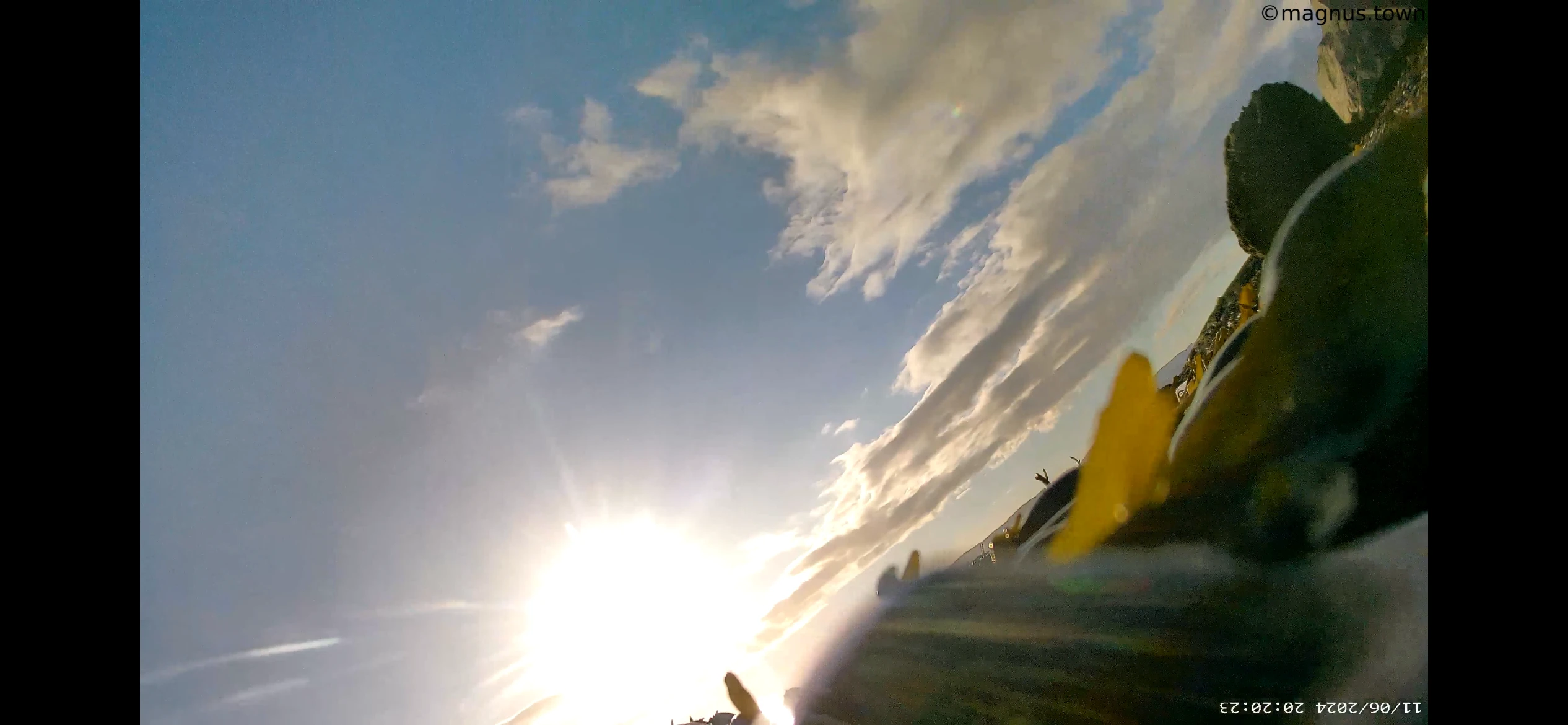
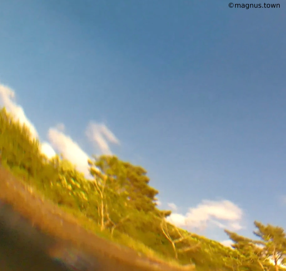
First of all, you can see that the sun is visible, low in the sky, and unobstructed. Some rounded (not steep/pointy) mountains are visible in the background. Some rocks can be seen in the foreground, leafy trees close to the shoreline, and a smooth rock slope with barely visible white veins.
Using the sun in comparison with the shoreline, we can see that the camera is pointing approximately Northwest. This means it certainly could not have reached the other side of the fjord yet, and all shorelines that place the sun on the right side can be excluded.
The terrain in the background looks like the fjord opposite Rosendal, where the mountains are less steep (roughly 300–400 meters). It drops down into a V shape in the NW direction.
Another interesting part is the timeline. At around 20:08, you see the bottom for the first time. The camera then spends five minutes floating with the sea bottom slowly getting more and more visible before getting trapped in some seaweed and floating around in almost the same place for a while. This could indicate that it is not a beach or a bank because then you would see the sea bottom for longer maybe?
Final location?
I looked at the metadata, but unfortunately, this camera does not log GPS location - Sad trombone.
To me, all of this evidence points to a location north of the starting place. I have managed to narrow down an area where I believe the camera ended up. I created a Google Earth map for this study.
First possibility
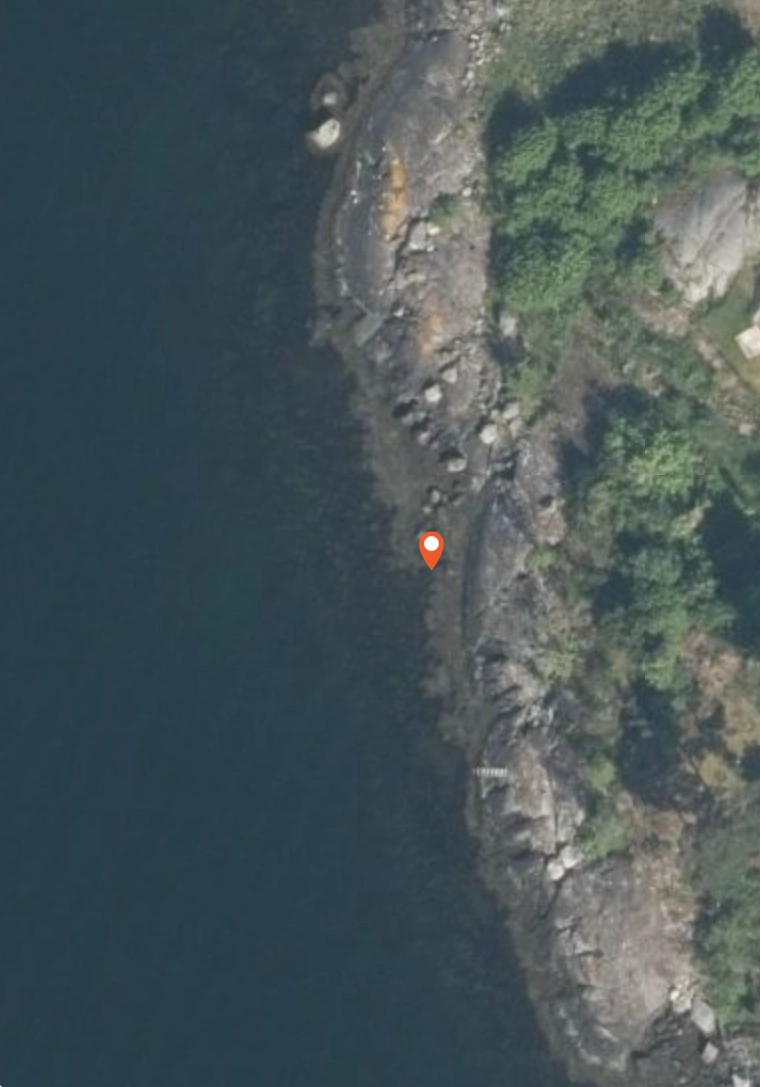
I have been back and fourth between serveral locations where I think the camera ended up and rested before running out of battery. The first one I looked at was just West of Røynholm at 60.0045766,5.9842101.
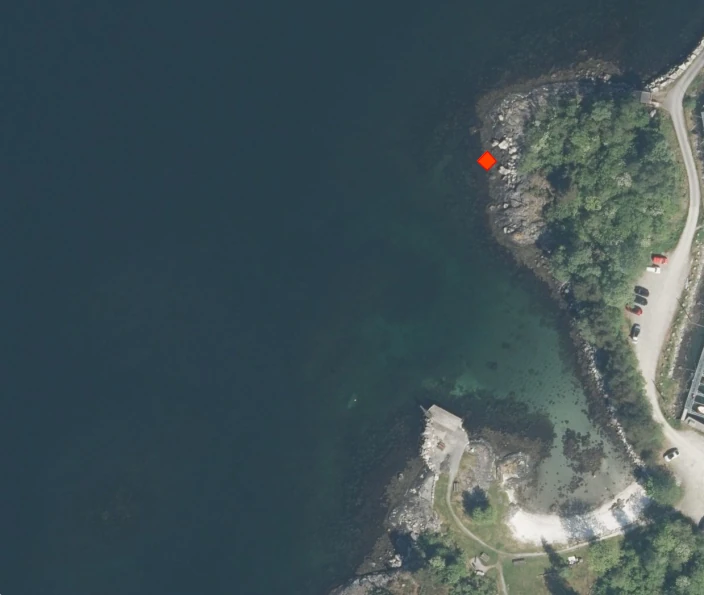
This location fits most of the evidence. It has a sightline to the mountains in the north with nothing blocking the foreground. It features a smooth rock surface behind sharper rocks that line up with the shore. The trees from the video match the flora in this location, and the trees grows right down to the shoreline.
In "Screenshot from the video 1," it seems like the trees grow in an upward direction away from the camera, with lower trees in the foreground. The shadows in the satellite photo confirm that there are indeed taller trees further inland on the coast.
An approximation of the total distance traveled is 950 meters. To cover 950 meters in 40 minutes, the camera needed an average drift speed of approximately 0.4 m/s (0.77 knots). This is a perfect match for the Hardangerfjord in June, where snowmelt creates strong surface currents, combined with a light summer breeze.
Analyzing the sun and the shadows fits as well.
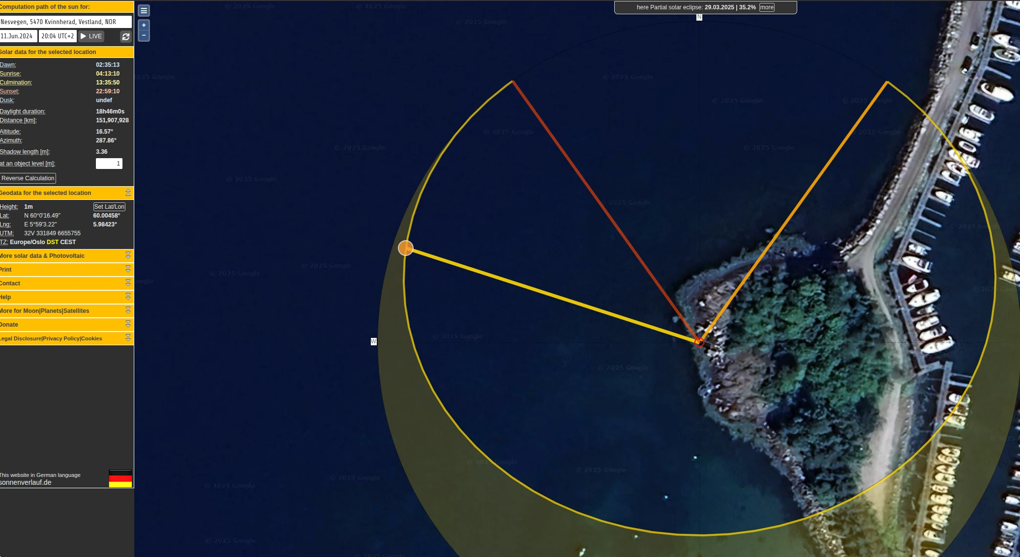
Comparing the shadows in the image with the direction of the sun on the rocks, the alignment is quite accurate. And because of all of these datapoints converge it makes sense that this would be where the video ended.
However, there are some evidence that points to this being the wrong location as well. First is the tide. The 11th of June 2024 it was a low tide, meaning some of the rocks you see on the video should have been covered by water when the tide is high again.
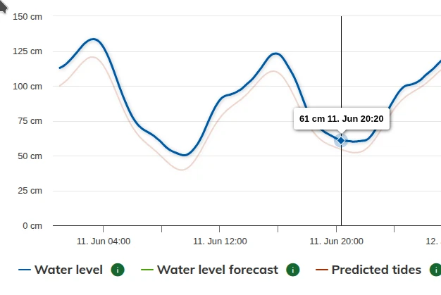
So I tried to find aerial photos of the same location with high and low tide, and I actually managed to find it. The screenshots below shows the same location with high and low tide.
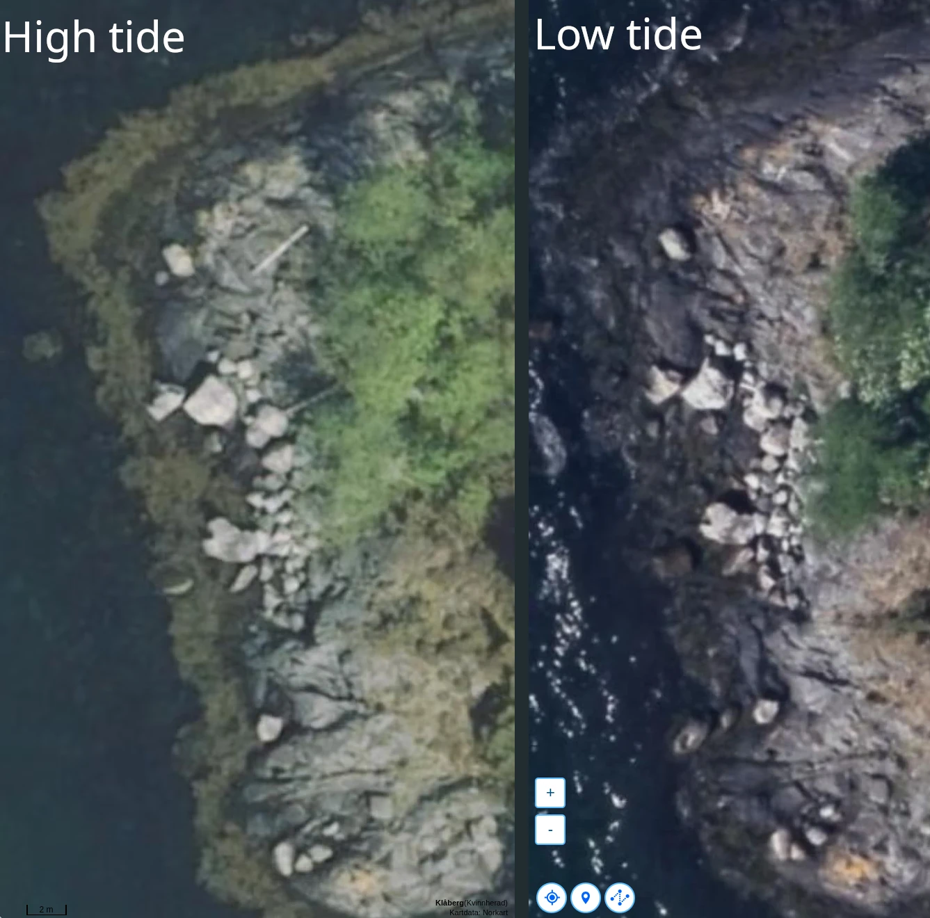
To me it shows that the rocks which I thought were the ones on the video are a bit more inland than stretching out in the water. Even in high tide the rocks does not seem to be covered with any water. This is the first piece of evidence that tells me that this is not the correct location, and I have to look somewhere else.
Second option
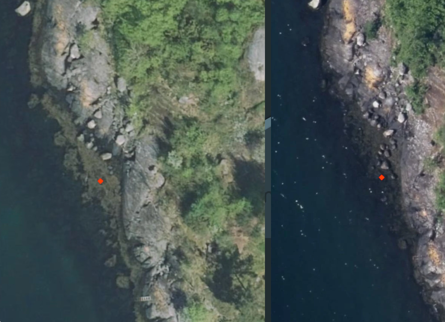
With all the facts in mind I started to look for another possible location and ended up with this, just south of Kolavika "59.9997299, 5.9818407".
This is a very similar location to the first one, and fits all the evidence there with regards to current, timeline, montains and sun looks about right too. However, this location is a bit different in some regards that makes it even more possible that this is the final location where the camera ended up. From sattelite photos it is possible see that the seabed is a bit steeper here before hitting the rocks. This fits with the timeline of drifting fore five minutes before getting stuck. The seabed is also covered in seaweed in this spot.
What made me doubt the first location was the tide and the rocks. Using the same maps as previusly we can see that rocks in the lower tide one (right) are even more exposed than in the left one where they are almost covered in water. This tells me that the rocks are exposed in water when the tide is low, just like in the screenshot from the cameras videofeed.
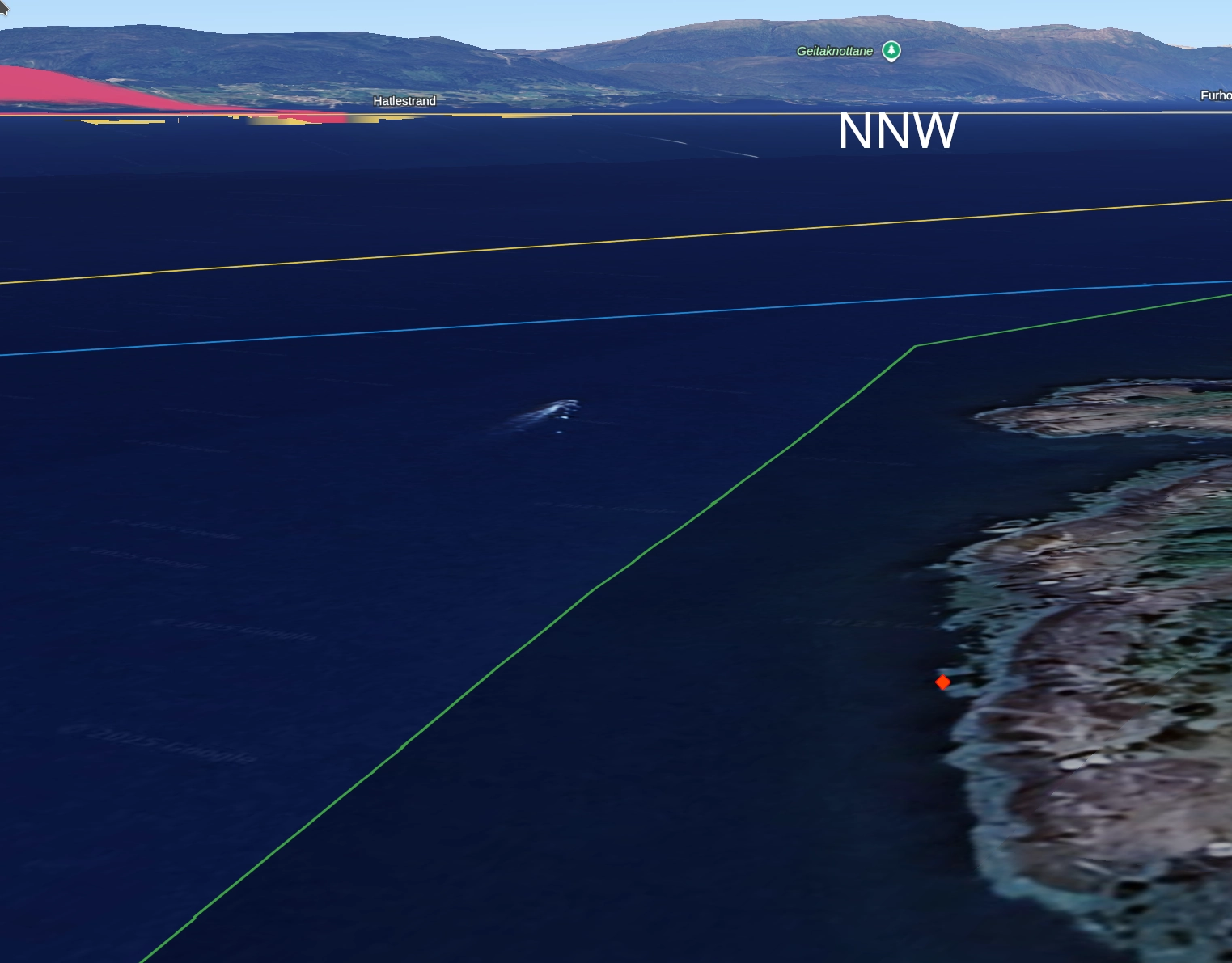
Even the background looks correct here. Using Google earth and the 3D feature there it is possible to get a quite good impression of the background. This fits with the "V" shape in the montains as well!
An approximation of the total distance traveled to this location is 500 meters. A drift of 500 meters over 40 minutes is highly realistic, as it implies a gentle average speed of approximately 0.4 knots, which aligns perfectly with typical coastal surface currents in the Hardangerfjord. Looking at the video it does not contain a lot of waves and it seems like a beautiful day out, so the slower drift might be more realisitc too.
So maybe this is the correct location? Using all the possible evidence I can think about I am settled with this being it.
Last thoughts
Of course, there is always a risk of confirmation bias and trying to find evidence that fits a preferred location. However, I have used the exclusion method to filter out locations where it could not be, eventually landing on this small area north of Rosendal.
If you think it is somewhere else, let me know!
It was a fascinating puzzle to solve using just a few leads. You can extract a surprising amount of information based on the sun alone. Now, I would really like to have the "correct" answer, but I suppose we will never know for sure. Thanks for reading.